Spring Fling @ the Sand Hills - CANCELLED Apr 11, 2020
Contact: Duane Barnett - DocDuane@AOL.com ~ OR ~ Tammy Reid - IronwoodFarm@Triad.rr.com
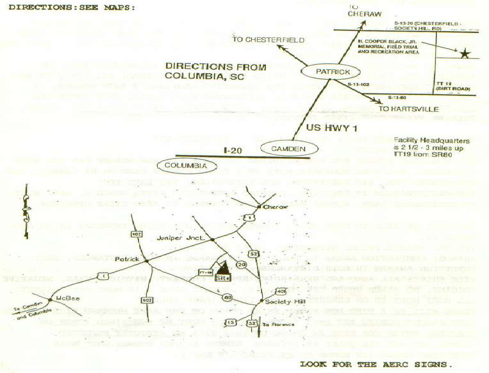
~ DIRECTIONS ~
LATITUDE/LONGITUDE
Latitude: 34.6976564 / Longitude: -79.8833971
From the West: Take I 85 to SC 5 to SC 521 Bypass 9 in Lancaster to SC 903 to SC 151 to US Hwy 1. It is 15 miles from McBee to Patrick on US 1. Turn right on to SC 102 and go 1 mile to fork in road. Bear left at fork on to SC 80. Go 4 miles to entrance to H. Cooper Black. Turn left onto sandy road and go 3 miles to Sporting Dog Rd and turn right. This is camp.
From the East: In Cheraw, take US 1/US 52/SC 9/ Market St. (these are all the same road) toward McBee or Columbia. Stay on US 1 about 5.6 miles. At the intersection of US 1 and Society Hill Rd. (Juniper Junction), turn left. Continue 5 miles to TT 19 (gravel/sandy road). There will be the H. Cooper Black sign just before the turn. Turn right and continue on TT 19 for 1 mile and turn left on to Sporting Dog Rd.

Friends of SERA